There are worse roads, but the one that makes me the most furious is I-376/US30/22, aka Fort Pitt tunnel and bridge.
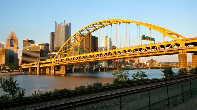
So you’ve never been to Pittsburgh, because it’s Pittsburgh, but you’re heading there because a sportsball team is playing someone black-and-yellow and you’re trying to impress your bang-buddy. You even offered to drive. You’re approaching the city, passing through rolling wooded hills dotted with houses and random businesses. GPS says you’re getting close. You start on a long downhill grade into the tunnel. You’re driving, driving, and then...BOOM. You’re almost immediately onto one of the 28 yellow bridges leading into Pittsburgh. The skyscrapers of downtown loom before you, the triangle where the Monongahela and Allegheny rivers meet to form the mighty Ohio. It’s a spectacular view, and you want to take it in, maybe even grab your phone and snap a quick pic.
Except you can’t. You have three seconds to know exactly which of the four northbound lanes you need to be in, or else you will end up on completely different sides of the city. Far left takes you to the North Shore (this is where you want to be for sportball), middle takes you downtown, and the right two take you through “The Bathtub” and towards the middle and western parts of the city. Doing this in heavy traffic (and it’s almost always heavy; this is the main funnel from the south) is not easy. Doing this in inclement weather is dangerous.
So most folk’s introduction to visiting Pittsburgh is “oh wow look at that—shit, I just missed the exit.”
I actually rather love Pittsburgh. But due to its location, it has the crumbling infrastructure of a Midwestern large city combined with the “lets build four roads over top of each other because water/something historic is in the way” aesthetic of a Northeastern one.
